Map of Phi Phi Islands
A map of Ko Phi Phi (Phi Phi Islands) is essential before visiting. The islands look small, but geography controls everything: where you can stay, how you move, and what you can realistically see in a day. Phi Phi Islands have no roads, no cars, and limited walking routes. Boats and footpaths define your trip.
Where Ko Phi Phi Is Located
Ko Phi Phi is part of Krabi Province, Thailand, in the Andaman Sea, roughly halfway between Phuket and Krabi Town.
The Phi Phi Islands are a small archipelago, but most maps focus on two islands only:
- Ko Phi Phi Don: The main inhabited island
- Ko Phi Phi Leh: The national park island where Maya Bay is located
Everything else you see on maps are smaller limestone islets.
Understanding a Ko Phi Phi Map
Most Phi Phi maps exaggerate distances. In reality, Phi Phi Don is narrow and walkable in parts, but broken by cliffs and bays that force boat travel.
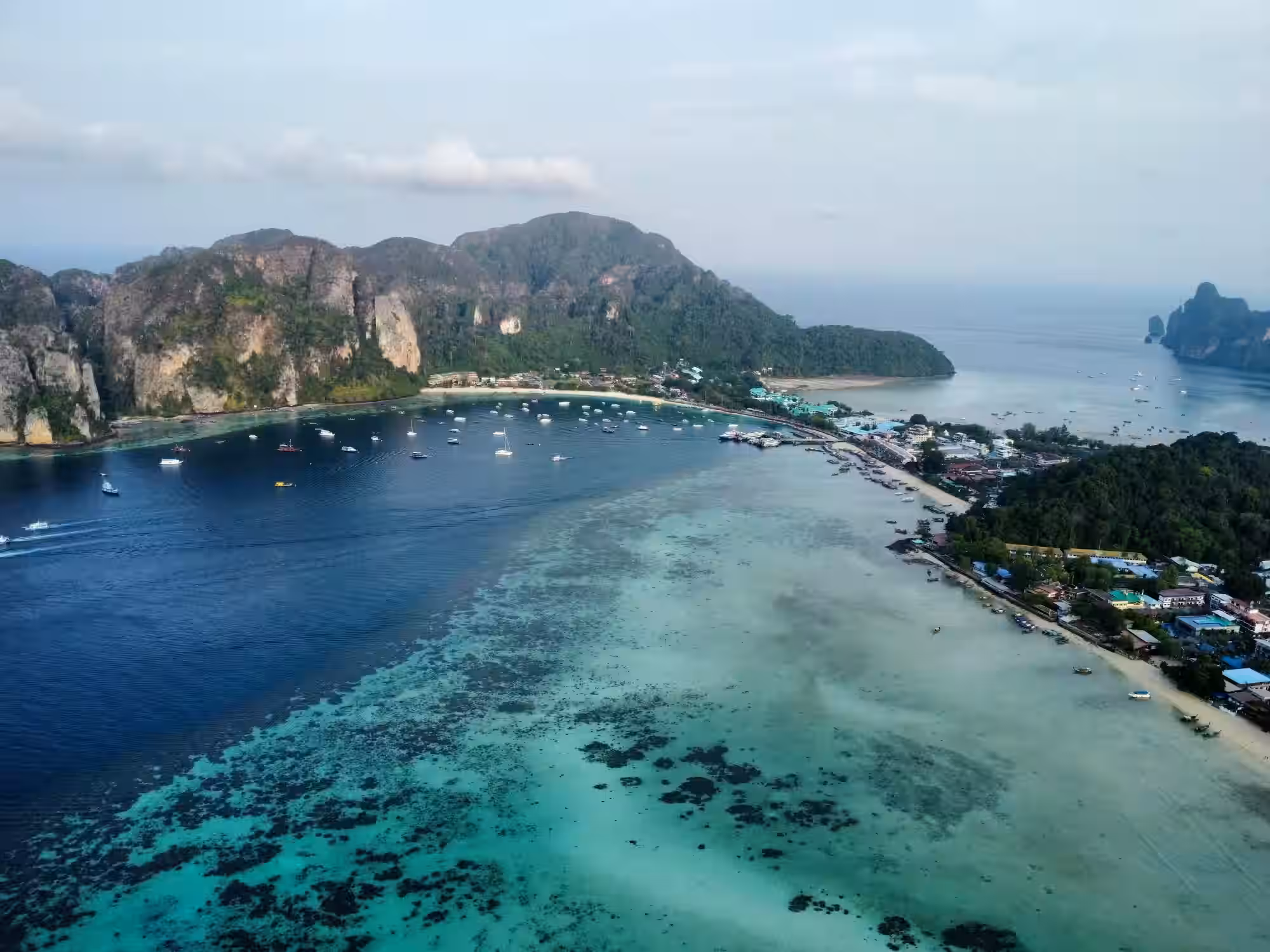
Map of Ko Phi Phi Don (Phi Phi Don Island)
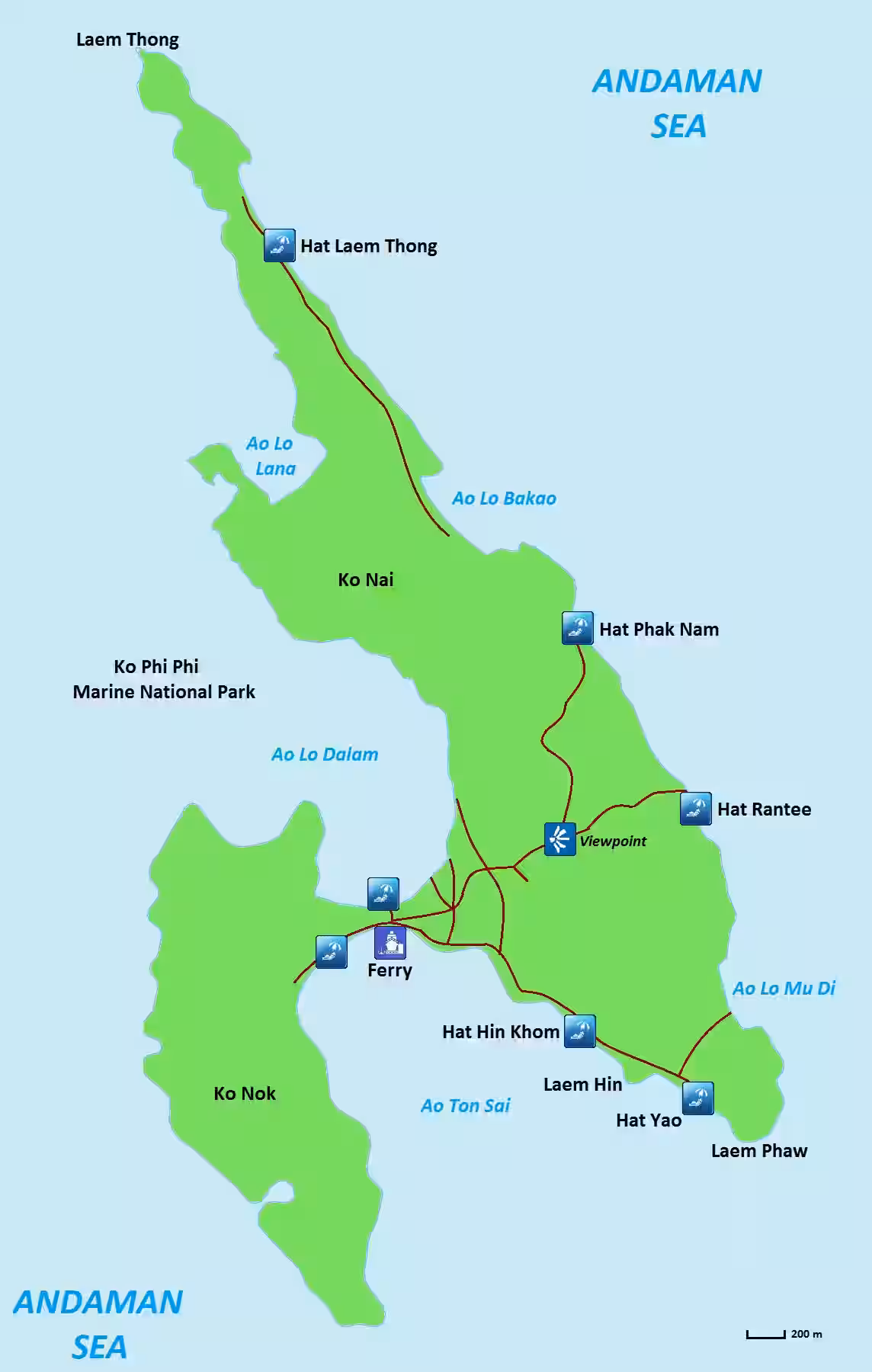
Ko Phi Phi Don looks like two hills joined by a narrow sand strip. That strip is the heart of the island.
Key areas you will see on any map:
Tonsai Bay
- Main ferry pier
- Arrival point from Phuket and Krabi
- Boat traffic hub
- Noisy and busy
If your hotel is near Tonsai on the map, expect crowds and nightlife.
Loh Dalum Bay
- The shallow bay opposite Tonsai
- Party beach
- Calm water in the morning, loud at night
Maps make Loh Dalum look peaceful. It is not after sunset.
Tonsai Village
- Shops, restaurants, dive centers
- All footpaths start here
- No vehicles, walking only
Distances on maps are misleading. Walking 500 meters here can take longer than expected due to crowds and sand paths.
Eastern and Northern Beaches
- Long Beach
- Laem Tong
- Loh Moo Dee
For more details on different beaches across Phi Phi Islands, see our dedicated Phi Phi Islands Beaches Guide.
Note: If your map shows your resort on the east or north coast, you will rely on longtail boats, not walking.
Map of Ko Phi Phi Leh (Phi Phi Leh Island)
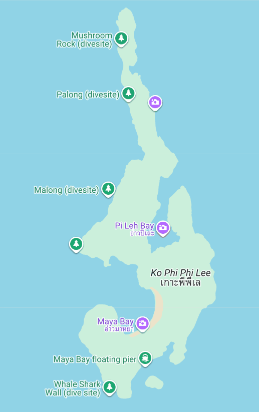
Ko Phi Phi Leh is uninhabited and fully protected.
Map highlights include:
- Maya Bay: Restricted access with strict rules
- Pileh Lagoon: Anchoring area for boats
- Viking Cave: Sightseeing only, no entry
- Loh Samah Bay: Secondary access to Maya Bay
If a map shows footpaths, ignore them. All access is by boat only.
Walking Distances vs Boat Routes
A common mistake when using a Ko Phi Phi map is assuming you can walk around the island.
Reality check:
- You cannot walk around Phi Phi Don
- Hills block coastal routes
- Some beaches are boat-only despite looking close
Example:
Long Beach looks close to Tonsai on the map, but walking takes over an hour through rough paths. A boat takes five minutes.
Viewpoints on the Map
Most maps show at least two viewpoints:
- Viewpoint 1: Easy, about 20 minutes uphill
- Viewpoint 2: Harder climb, best sunset view
These viewpoints sit on the central hill and explain why the island is split in two. When you see elevation lines on a map, take them seriously.
Ferry Piers and Transport Points
A proper Phi Phi map should show:
- Tonsai Pier
- Longtail boat routes
- Day tour anchor zones
There is only one ferry pier on Phi Phi Don. If your hotel is far from it on the map, plan a paid boat transfer.
Frequently Asked Questions
Is Ko Phi Phi Don walkable?
Partially. The village area is walkable. Most beaches require boats.
Does Google Maps work on Phi Phi?
Yes, but paths are incomplete. Download offline maps.
Are distances on Phi Phi maps accurate?
No. Elevation and terrain matter more than distance.
Can I use a paper map on arrival?
Yes. Many hotels and tour desks provide free maps.